Balsam root flowers bloom near Missoula, Montana. (Image by Danita Delimont, Shutterstock)
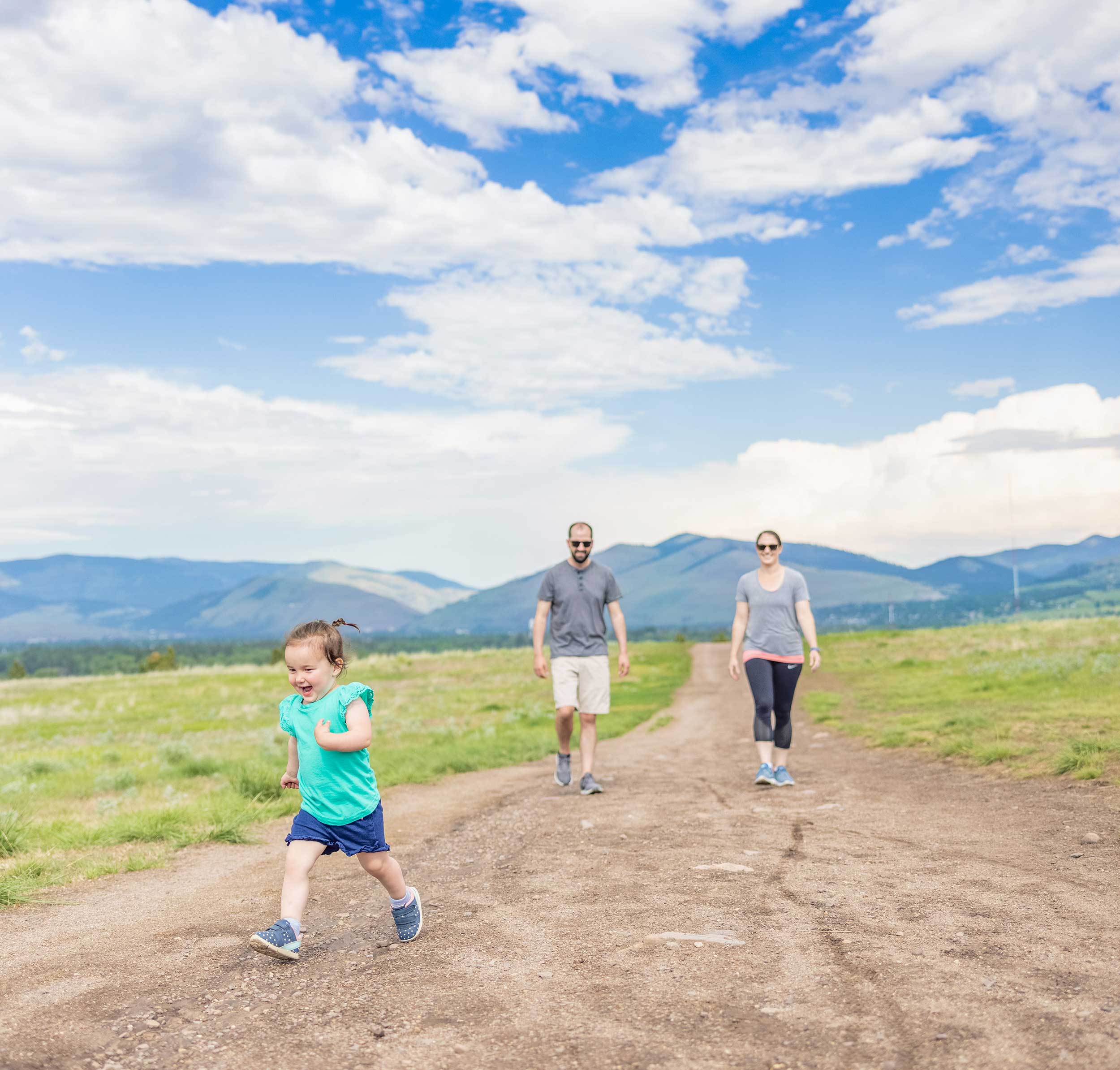
If you’ve ever been to the Missoula, Montana, area, you may have picked up on the fact that people who live there love to hike. And for a lot of people, hiking is more than a weekend hobby: It’s sort of a way of life. Nestled in the Northern Rockies and surrounded by public lands, this lively college town offers trails in every direction, from shaded creekside hikes to mountain ridge treks with sweeping views.
But not every hike needs to be a full-day commitment. Whether you’re a seasoned trekker looking for a quick outing or a newcomer just lacing up your shoes (or boots), there are trails that offer beauty without the burn.
“Montana has the moniker of the last best place, and I think this applies to the hiking experience perfectly,” said Maggie Carr, co-owner of Dropstone Outfitting LLC. “There are certainly spots you can go and see other folks hiking, but it’s not unusual to go on a hiking trip and not see another soul.”
Still, it’s important to hike smart. “Always carry your bear spray in areas that have grizzly and black bear populations,” Carr added. “Check in with the local Forest Service or land agency, bring first aid and plenty of food and water.”
Paul Belanger, guide and owner of Bitterroot Alpine Guides in Hamilton, agreed.
“Anywhere in Montana, carry bear spray and learn the seven Leave No Trace principles,” he said. “It’s about minimizing your impact so that the outdoors remain accessible and beautiful for everyone.”
Whether you have 45 minutes or a half day, the list of hikes below are approachable, scenic, and flexible. You can hike out as far as you want, then turn around whenever you’re ready.
While some of the full trail routes may be rated moderate or even difficult due to mileage or elevation gain, each can easily be customized into a shorter outing with a rewarding experience.
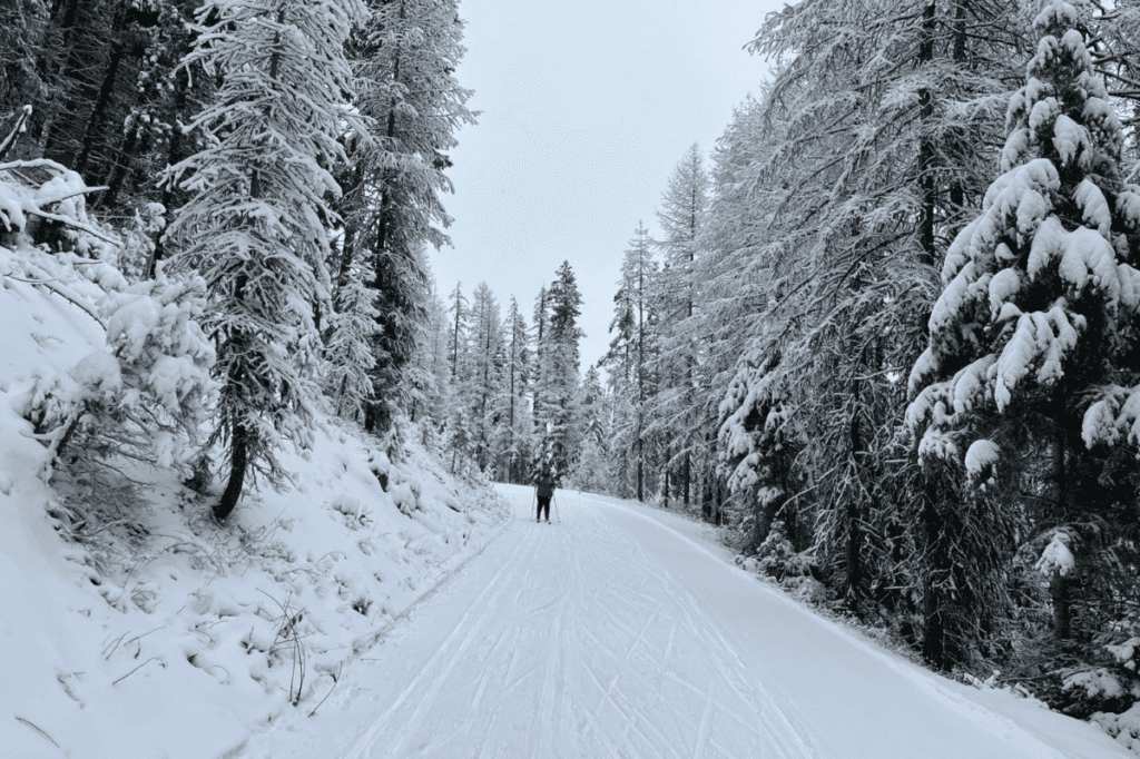
Barmeyer Trail
Barmeyer Trail (Image courtesy of Destination Missoula)
- Trailhead Location: Pattee Canyon Rd (near Dean Stone Preserve)
- Distance (full out & back): ~3.5 miles
- Elevation Gain: ~900 feet
- Trail Map & Info: Trailforks – Barmeyer Trail
The Barmeyer Trail is a gem tucked into the South Hills of Missoula, offering you one of the best payoff-to-effort ratios around. Starting from Pattee Canyon, the trail meanders through pine forests with manageable switchbacks, gaining elevation gradually until you reach a scenic overlook with panoramic views of Missoula Valley and the Clark Fork River.
The full loop is under 4 miles, but the beauty of this trail is its flexibility. Even a 20-minute out-and-back gives you a peaceful forested escape, and the gradual incline makes it accessible for families with children, leashed dogs or hikers adjusting to altitude.
Tip: If you’re short on time, hike to the first overlook (~1 mile in) and turn back. You’ll still get a great workout and stellar views.
Safety Note: Bring bear spray and be alert for mountain bikers. This is a multi-use trail.
Morrell Falls National Recreation Trail
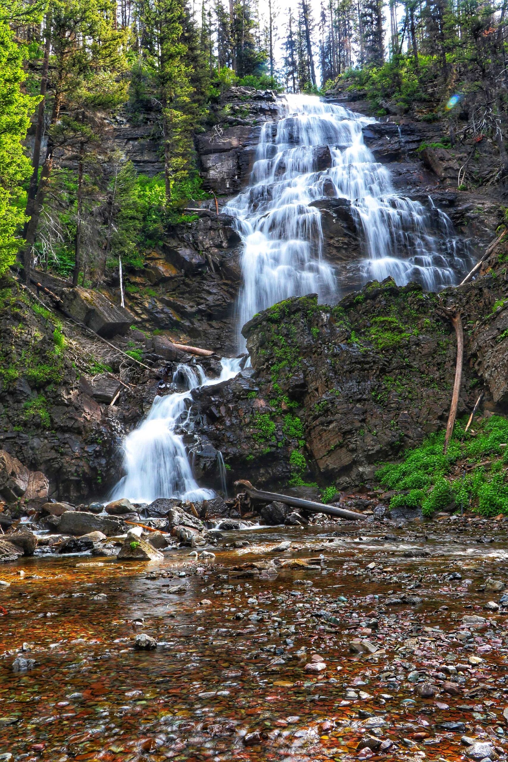
Morrell Falls National Recreation Trail (Image courtesy of Destination Missoula)
- Location: Seeley Lake, MT (~1 hour from Missoula)
- Distance (full out & back): ~5.2 miles
- Elevation Gain: ~400 feet
- Trail Info: AllTrails – Morrell Falls
This trail is a relatively flat, well-marked path through lodgepole pine forests that leads to the double-tiered Morrell Falls—a cascading waterfall. Located near Seeley Lake, this hike is popular with families, anglers and day hikers.
Rated as moderate (primarily because of the length), Morrell Falls is more than manageable if you just want a scenic nature walk. You’ll pass meadows, cross small creeks, and may even see signs of beaver activity along the way.
Tip: Hike out as far as you’d like. There’s no pressure to make it all the way to the falls. Even walking the first mile offers you a peaceful forest immersion and mountain air.
Pro Insight: “Sometimes, the journey is more important than the destination,” said Paul Belanger. “There’s any number of factors that may prevent someone from reaching their destination — weather, wildlife — but it can still be an amazing journey.”
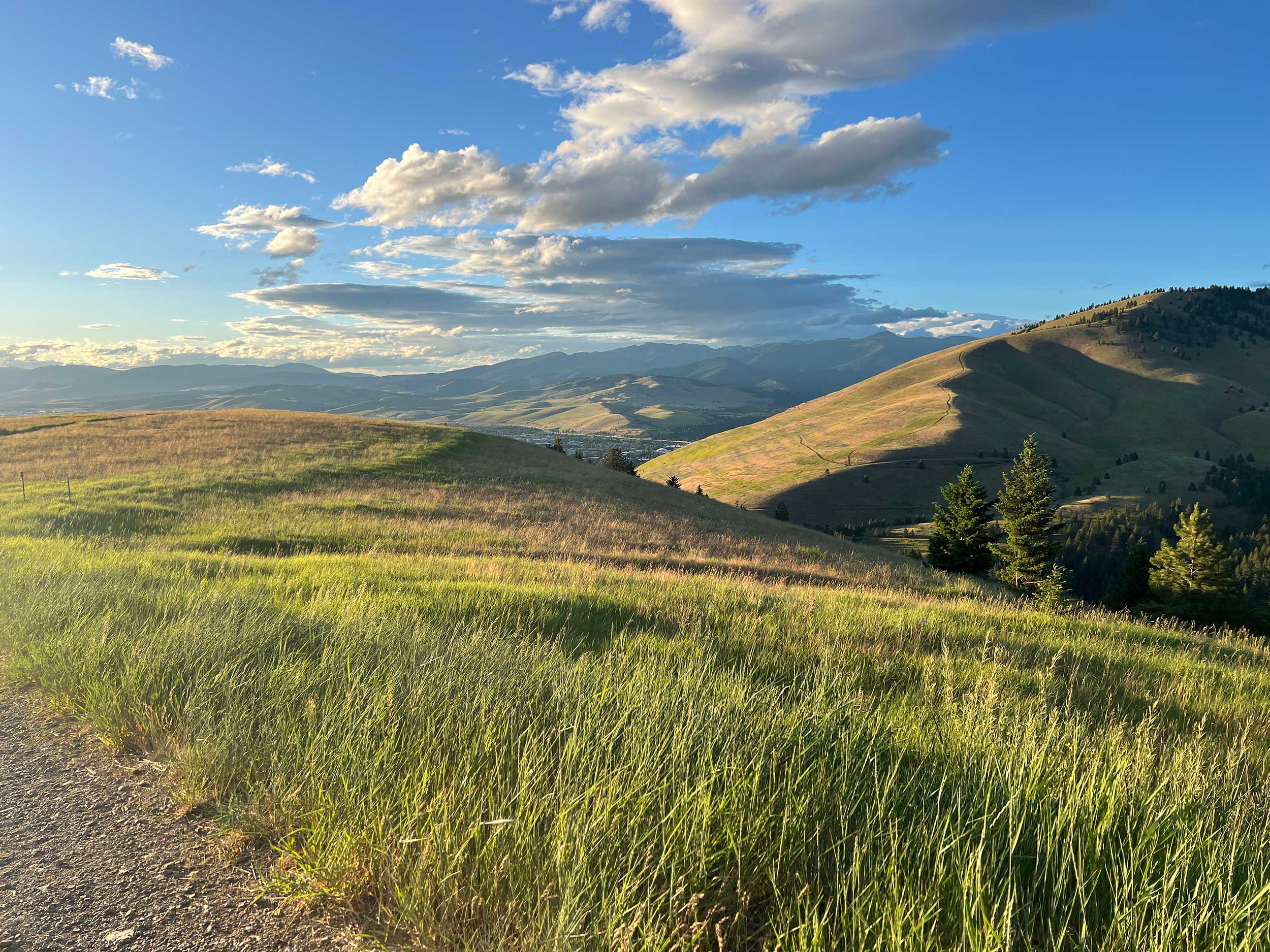
Blue Mountain Recreation Area
Blue Mountain Recreation Area (Image courtesy of Destination Missoula)
- Trailhead: Blue Mountain Trailhead, off Blue Mountain Road
- Multiple Trail Options: Choose-your-own-length
- Popular Route Example: Trail 3.01 to overlook (~2.5 miles round trip)
- Trail Info: USFS – Blue Mountain National Recreation Area
Just a 10-minute drive from downtown Missoula, the Blue Mountain area offers a network of trails suitable for everything from easy strolls to strenuous summit pushes. The trail system allows you to craft your own adventure depending on your time and energy.
One of the easiest and most scenic options is the short trek from the main trailhead to the overlook on Trail 3.01. It’s an open climb with sweeping views, especially at sunset. The exposed terrain also makes it a great spring and fall hike when you want sunshine.
Tip: Bring sunscreen. This trail has little shade. And don’t be afraid to turn around whenever you’ve had your fill. The open views start within the first half mile.
Local Wisdom: “For those that want to explore the backcountry safely and respectfully, just start small and do hikes within your own capability,” said Akio Joy of Beartooth Mountain Guides. “Have a plan with a buffer and a backup plan.”
Rattlesnake Recreation Area – Main Corridor Trail
Rattlesnake Recreation Area (Image courtesy of Destination Missoula)
- Trailhead: Rattlesnake Main Trailhead (Rattlesnake Drive)
- Distance (out & back): Up to 16 miles, but flexible
- Elevation Gain: Variable, gentle grade
- Trail Info: AllTrails – Rattlesnake Main Trail
If you’re looking for a choose-your-own-adventure style hike with easy terrain and wide gravel paths, the Rattlesnake Corridor Trail is your go-to. This well-loved route starts in a shaded forest and follows a stream through a glacial valley. You’ll pass bridges, meadows and maybe even the occasional moose.
Although the full trail is long, many locals use the corridor for morning walks, dog outings or quiet reflection. Hike in 1 to 2 miles and turn around. Remember, there is no pressure to complete the entire length.
And if you’re nervous about encountering some nope-ropes along the way, you can breath easy. The Rattlesnake National Recreation Area is named after Rattlesnake Creek, which runs through the region. There are two main theories on why the creek is called Rattlesnake. One suggests it was named after a Salish word meaning “rattlesnake.” The other proposes it was named after an incident in the 1800s where a man died after being bitten by a rattlesnake while gathering wood along the creek. Despite the name, there have been no verified sightings of rattlesnakes within the recreation area, according to The Missoulian.
Tip: This trail is great for families and stroller-friendly for the first few miles. Bikes are allowed, so keep an eye out.
Cultural Note: “Always keep in mind that we exist in a world of shared spaces and relationships,” said Derek DesRosier of Sun Tours. “That extends to all other beings that call this place home.”
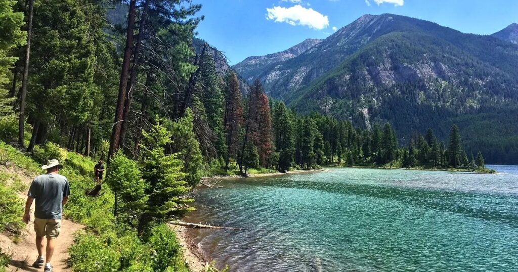
Bass Creek Trail
Bass Creek Trail (Image courtesy of Destination Missoula)
- Location: Bass Creek Recreation Area, near Stevensville (~45 mins south of Missoula)
- Distance (full out & back): ~7 miles
- Elevation Gain: ~800 feet
- Trail Info: AllTrails – Bass Creek Trail
Bass Creek Trail is located in the beautiful Bitterroot Mountains and follows a bubbling creek past boulder fields, wildflowers and dramatic canyon walls. Though rated moderate due to its total distance, the first couple miles are relatively easy and packed with beauty.
The wide, shaded path makes it one of the best family-friendly hikes in the Bitterroot. In late spring and summer, wildflowers bloom and the creek runs high — perfect for a picnic on a flat boulder. And in the fall, golden aspens light up the landscape.
Tip: Hike to the first footbridge (~1.5 miles in) and turn around for a 3-mile round-trip walk that feels like you’ve gone deep into the mountains.
Respect the Land: “Take your time to appreciate where you are and recognize that public lands are for everyone,” Belanger reminds. “And without those, we could not have those hiking experiences.”
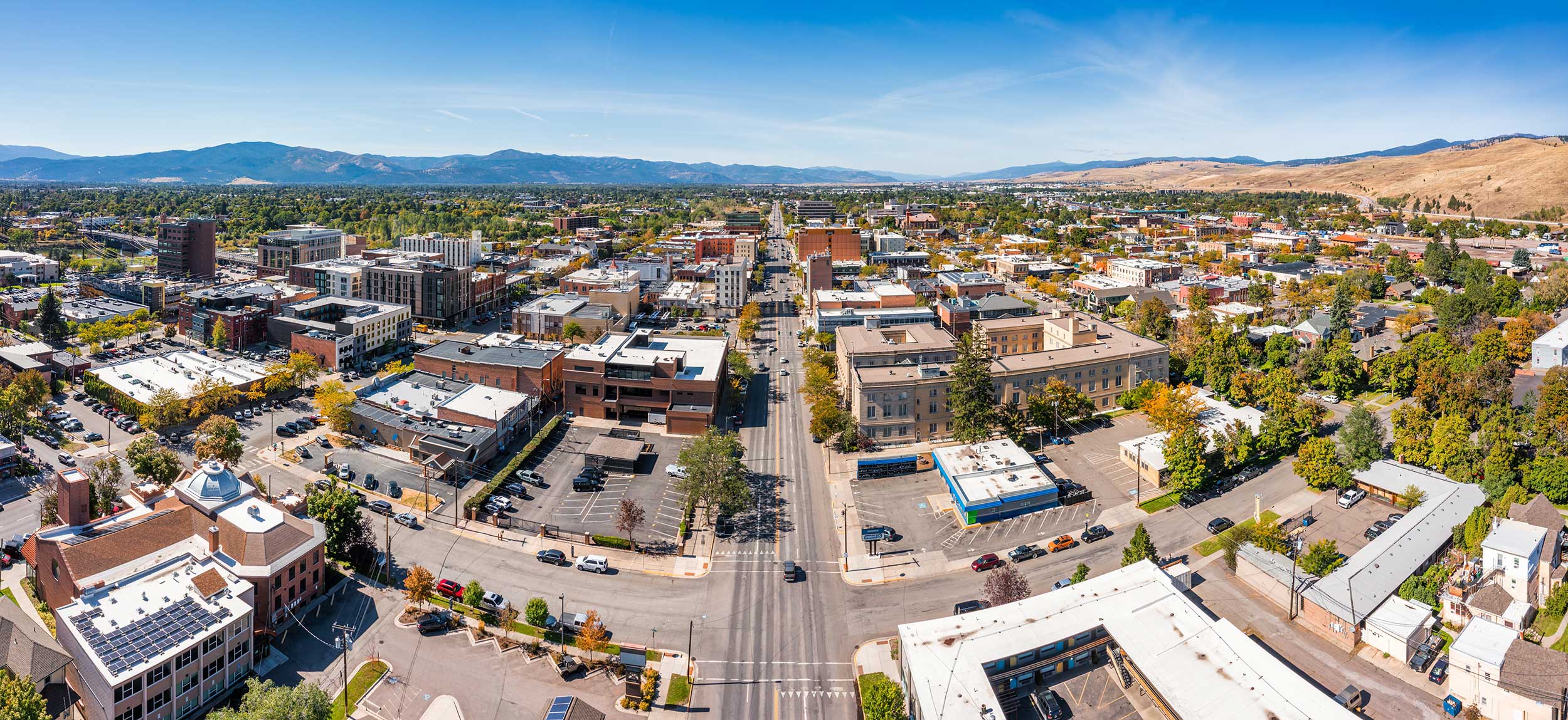
An aerial of the town of Missoula, Montana (Image by Mihai_Andritoiu, Shutterstock)
When You Go
Montana’s landscapes are challenging from a distance, but that doesn’t mean you have to be a mountaineer to enjoy them. From forested foothills to valley waterfalls, Missoula’s trail systems invite everyone to take part in the experience of nature, no matter their pace or ability.
“Go out there and have fun,” said Joy, the mountain guide. “Be open-minded to the hikes, get off the beaten path, and figure out what works for you. Ask locals for advice.”
And remember: You don’t have to finish a trail to enjoy it. Sometimes, the best part of the hike is simply getting outside and breathing the mountain air, even if it’s only for a mile.
Gear Up and Go
- Essentials: Water, snacks, layers, bear spray
- Pro Tip: Download maps ahead of time—cell service can be spotty
- Trail Etiquette: Leave no trace. Pack out all trash, give space to wildlife, and respect other users
Explore More Trails Near Missoula
Suzanne Downing is an outdoor writer and photographer in Montana with an environmental science journalism background. Her work can be found in Outdoors Unlimited, Bugle Magazine, Missoulian, Byline Magazine, Communique, MTPR online, UM Native News, National Wildlife Federation campaigns and more.

(function(d, s, id) {
var js, fjs = d.getElementsByTagName(s)[0];
if (d.getElementById(id)) return;
js = d.createElement(s); js.id = id;
js.src = “//connect.facebook.net/en_US/all.js#xfbml=1”;
fjs.parentNode.insertBefore(js, fjs);
}(document, ‘script’, ‘facebook-jssdk’));
Source link
Discover more from Gear Up!
Subscribe to get the latest posts sent to your email.